Within the borders of Tellico Village are more than 20 miles of walking and hiking trails.
More than 20 miles of hiking and walking trails zigzag through several Tellico Village neighborhoods. Almost all of the trails have been built by resident volunteers. One of the most popular walking venues is found outside the Wellness Center: a paved half-mile pathway that encircles the facility. There are four exercise stations donated and installed by the Tellico Village Lions Club on the walkway which can be used by able bodied as well as physically challenged individuals. At various points off the paved loop are entry points to a warren of trails leading off into nearby forests and some winding down to Village Square, the nominal center of the community.
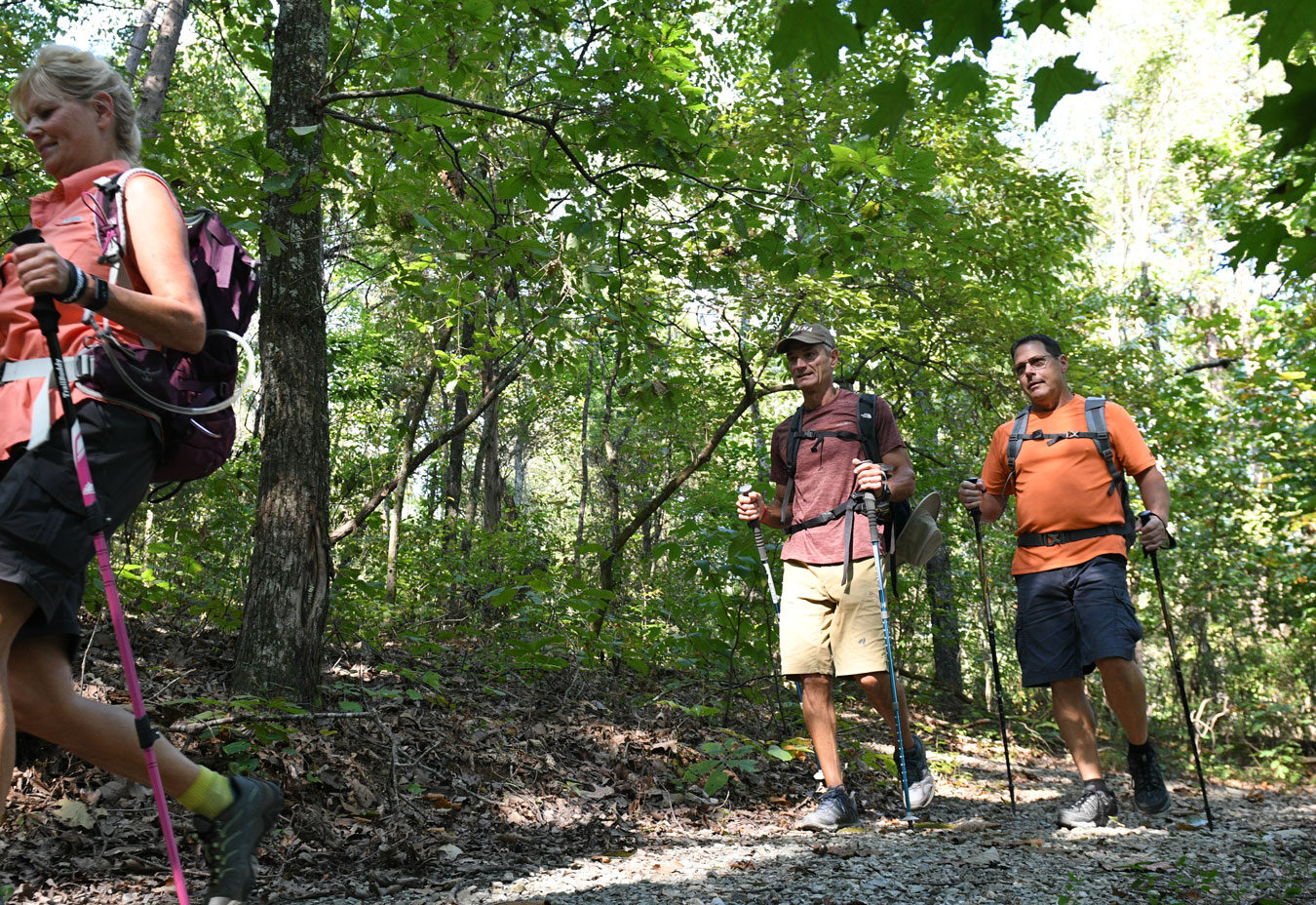
Across Tellico Parkway, running parallel to Toqua Road, is the Toqua Walking Trail that pops in and out of forested areas and skips by the Toqua Golf Course. This back and forth trail takes about 45 minutes to walk. In the Coyatee neighborhood a little more than a one-mile hiking trail twists through the Coyatee Reserve with modest elevations and a forest pond. On the Coyatee trail, residents can get into the woods without leaving the community. A combination walking/hiking trail meanders more than three miles through the Kahite neighborhood moving through treed areas, opening spaces and skirts Tellico Lake. The trail-builders are not finished. Plans are continuing to evolve for a more expansive trail system throughout the community.
East Lakeshore Hiking Trails
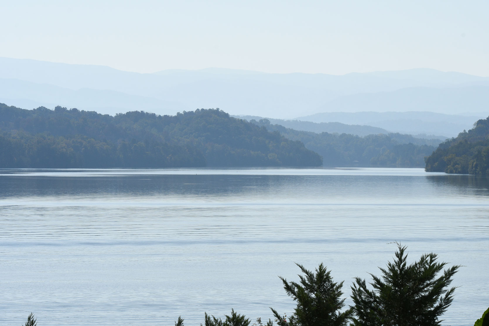
Across Tellico Lake on the east shoreline is a 30.3 mile trail system known as the East Lakeshore National Recreation Trail at Tellico Lake. Starting at the Tellico Dam and wandering through forests, circling lake inlet after lake inlet, slowly bouncing up and down the gentle foothills that border the lake, the trail network ends just north of Route 411 in Monroe County. Built by the Watershed Association of Tellico Reservoir (WATeR) and the Tennessee Valley Authority over a 13 year period, the system’s nine trailheads are within a 20 to 30 minute drive of Tellico Village. WATeR is comprised of Villagers and other lake residents who maintain and repair the trails on a regular basis. In May 2012, the United States Department of Interior recognized the East Lakeshore Hiking Trails as part of the United States National Trails system.
The “Boy Scout” Trails
Between the northern border of Tellico Village and Tellico Dam, just off Route 444 is a series of hiking trails known to Village residents as the “Boy Scout” Trails. The system was originally built by Loudon County Troop 54 of the Boy Scouts of America. Much of the trail twists along the shores of Tellico Lake with a few slight elevations that afford panoramic views of Tellico Lake, the Village and Smoky Mountains.

Great Smoky Mountain National Park Other Hiking Options
For the truly serious hikers, East Tennessee presents some of the best hiking in the country. Great Smoky Mountain National Park is 45 minutes from the Tellico Village and offers hiking experiences for the novice to veteran hiker. Big South Fork National Recreation area is two hours away and a location where many Villagers hike. There are also numerous trails in the Cherokee National Forest and throughout the Cumberland Mountains. Accessibility to great hiking is another reason why Tellico Village is viewed as one of the best retirement communities in Tennessee.
Visit Us Today Request Information
Get to know us a little better, ask for a free info packet. Or book a day tour or experience package.
Discovery Packages